1
/
of
4
Calazo Förlag
Stikart Trondheim & Malvikmarka 1:25 000
Stikart Trondheim & Malvikmarka 1:25 000
Regular price
$17.53 USD
Regular price
$26.56 USD
Sale price
$17.53 USD
Unit price
/
per
Shipping calculated at checkout.
Couldn't load pickup availability
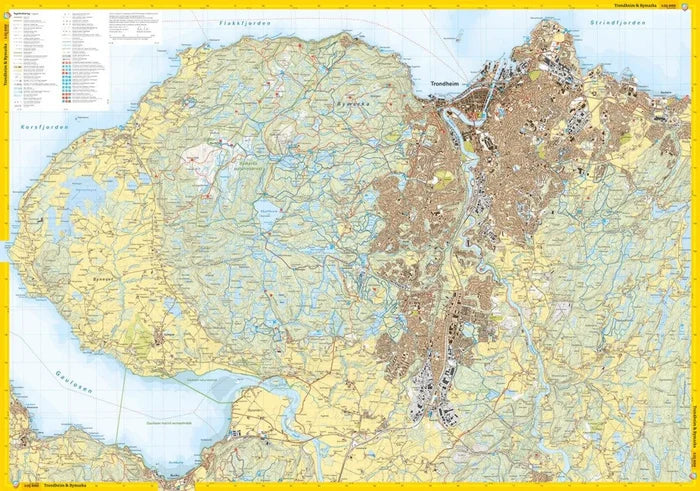
Trondheim, Malvik and Stjørdal are surrounded by beautiful outdoor areas offering opportunities for hiking in forests and mountains, as well as activities by the sea throughout the year. This map highlights the many possibilities and the great variety of nearby outdoor experiences.
In Bymarka as well as Mostadmarka, Jonsvannsmarka and Malvikmarka, there is an extensive network of trails and ski tracks, groomed cross-country ski trails in winter and well-marked hiking routes in summer. The pilgrimage routes come from all directions and lead towards Nidaros Cathedral. The map also includes bathing spots, accessible recreation areas, popular summit hikes and viewpoints.
The Trondheim and Malvikmarka map is published by Calazo Förlag following input from key hiking and outdoor organisations in the region. It is part of a modern map series where terrain information is based on airborne laser scanning, providing exceptional detail and an almost three-dimensional impression. The map includes all marked hiking trails, ski tracks, bathing spots and kayak rentals in the entire coverage area and is designed for year-round use.
Double-sided map: 70 × 100 cm.
In Bymarka as well as Mostadmarka, Jonsvannsmarka and Malvikmarka, there is an extensive network of trails and ski tracks, groomed cross-country ski trails in winter and well-marked hiking routes in summer. The pilgrimage routes come from all directions and lead towards Nidaros Cathedral. The map also includes bathing spots, accessible recreation areas, popular summit hikes and viewpoints.
The Trondheim and Malvikmarka map is published by Calazo Förlag following input from key hiking and outdoor organisations in the region. It is part of a modern map series where terrain information is based on airborne laser scanning, providing exceptional detail and an almost three-dimensional impression. The map includes all marked hiking trails, ski tracks, bathing spots and kayak rentals in the entire coverage area and is designed for year-round use.
Double-sided map: 70 × 100 cm.
Share